Ratan and Rataskär
After a journey on a narrow meandering country road,
first-time visitors to Ratan find themselves in a tiny, sleepy
village with small, beautiful old wooden houses, a few meadows
of grazing sheep and a marina, all facing a sheltered inlet. After
a brief stop, history novices may find it easy to just continue
their journey down to the harbour and then just remember Ratan
as the lovely little village by the shore. But Ratan is more than
just peace and quiet. Ratan is responsible for a large chunk of
northern Swedish coastal history. Had events been different, what
is today northern Sweden's biggest city, Umeå, might have
ended up in Ratan instead!
All began when the farmers in Djäkneboda demanded
the right to have a market here. Conditions for a harbour were
ideal, with its sheltered position behind the island Rataskär,
otherwise known as Båkskär. One requirement for establishing
a new marketplace was that the farmers had to build a pub and
the building came to be the first in the area. When you visit
Rataskäret you can see the foundation of the old pub.
Ratan's true glory days were during the eighteenth century,
when it became "Northern Sweden's Harbour" as it became
the staple town or port for the Västerbotten cities of Umeå,
Piteå, Luleå and Torneå. Ratan was considered
to have the finest harbour along the entire Norrbotten and Västerbotten
coasts. These cities' ships were forced to put into this port
to have their goods cleared by customs. A maritime customs house
was established and built on Rataskär and warehouses were
built for the different cities. Pilot and customs personnel built
houses on the mainland and farmed.
The last war fought on Swedish soil, the war against Russia
1808-1809, brought hard times for Ratan. On 20 August 1809 the
Swedes and Russians fought a major battle; Ratan was the battlefield
and the residents returned to find their farms shot up, their
belongings scattered and their stores plundered. Today's visitors
to Ratan find memories of the war in the form of defences and
graves, as well as the occasional bullet hole in some of the houses.
In addition to Ratan's place in history as a harbour and
battleground, its name has also become known in a completely different
context. Every day the name Ratan is heard on the Swedish marine
weather forecast. When interest in the land uplift or "decrease
in water" grew during the nineteenth century, Ratan played
a central role. Scientists monitored this remarkable phenomenon
here and in 1849 a scientist from Ostrobothnia cut the first water
level mark in the rock on the mainland. It was the first of many.
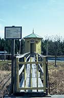
A mareograph - a water gauge - was also built inside the harbour
in 1891. Today there is a new mareograph and reports from it are
heard every day on Swedish radio.
Visitors to Rataskäret should naturally follow the
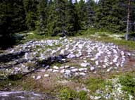
little history trail around portions of the island. During a kilometre-long
stroll you will see and learn more about labyrinths, compass roses,
"gistvallar" (racks for drying fishing nets) and "tomtningar"
(remains of ancient house foundations). Along the path you will
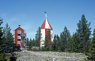
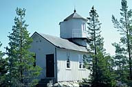
also pass the lighthouse, which was built in 1891. At the top
of the island is the old light beacon, which long ago served as
the pilot look-out tower during the time that Ratan was a separate
pilotage district.
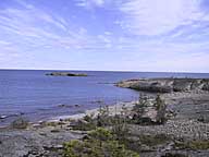
The nature on Rataskäret is typical for the Västerbotten
coast with its land uplift. The island is 21 m above sea level
at its highest point in the village; below this peak are beautiful
cliffs, spruce forests and a small lake on the north side of the
island. Much of Rataskäret is protected as a nature reserve
and the entire area around Ratan and Rataskäret are classified
as sites of historic interest and have been granted heritage protection.
| 
